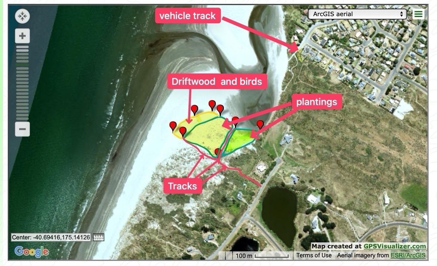
I don’t know why I never thought to do this before … Today I took several photos with my iPhone, exported the GPS data and then made a map to show where the new spinifex plantings and driftwood are, south of Waikawa River and estuary.
I used gpsvisualizer.com and Shottr to help.