
Catlins Day One: lighthouse, Jurassic fossil forest
This morning we picked up a rental car, squeezed in ourselves and our luggage, picked up groceries and squeezed them in too and headed from Invercargill, Waihōpai, for The Catlins.
There was no hurry — this part of our holiday is a tour of an area none of us has visited before.
Our first stop came quickly: Fortrose, where there are 400 hectares of tidal flats.
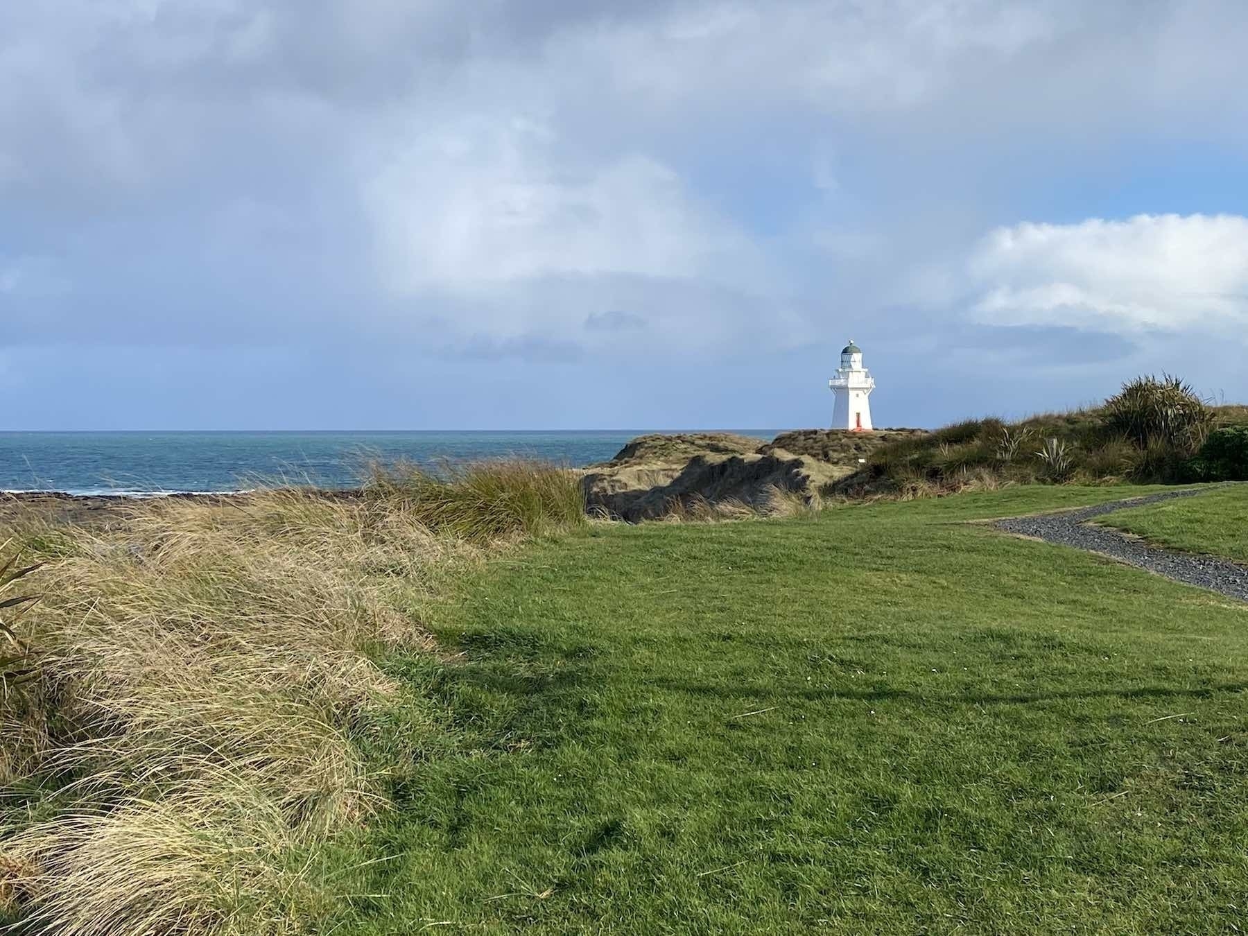
Next up was Waipapā Point with its lighthouse, built subsequent to New Zealand’s worst civilian shipwreck. The Tararua wrecked in 1881; 131 lives were lost.
There was a bitterly cold wind when we visited — probably very usual for this area.
We soon moved on to Slope Point, the southernmost point on the South Island. There’s a marker down on the coast but with the bitter wind and a slew of mud I opted just to view it all from the carpark.
That led us to Curio Bay, Tumu Toka, site of a 180 million year old Jurassic fossil forest, best seen within 2 hours of low tide. Our timing was lucky, and we went down the many steps to the shore.
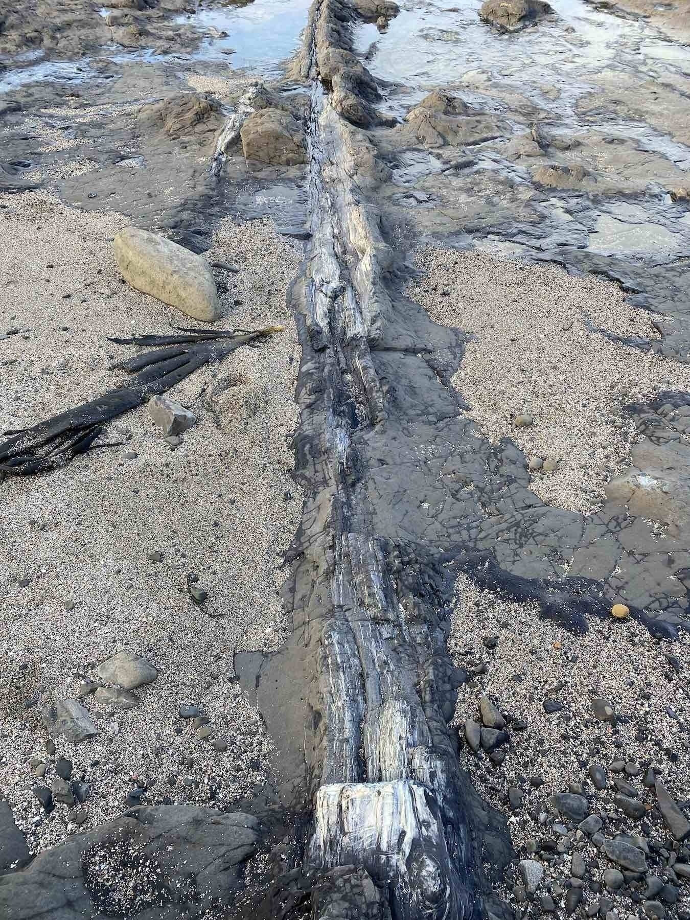
The petrified trees were amazing: they looked just like logs of wood, but felt like stone.
Apparently they were the result of rain and volcanic ash flooding forests back when Aotearoa New Zealand was part of Gondwanaland:
Millions of years ago the Curio Bay area was part of the eastern margin of the ancient super continent Gondwanaland. The forest was destroyed multiple times by massive sheet floods of volcanic debris; growing back only to be covered again. These events are clearly recorded by distinct bands of fossils in the now exposed cliff face. The erosion of the sea has exposed tree stumps, logs and other fascinating fossils.
We had lunch at the humorously named tiny waterfall known as Niagara Falls and ended up at The Whistling Frog for the night.
Tuesday 27 July 2021